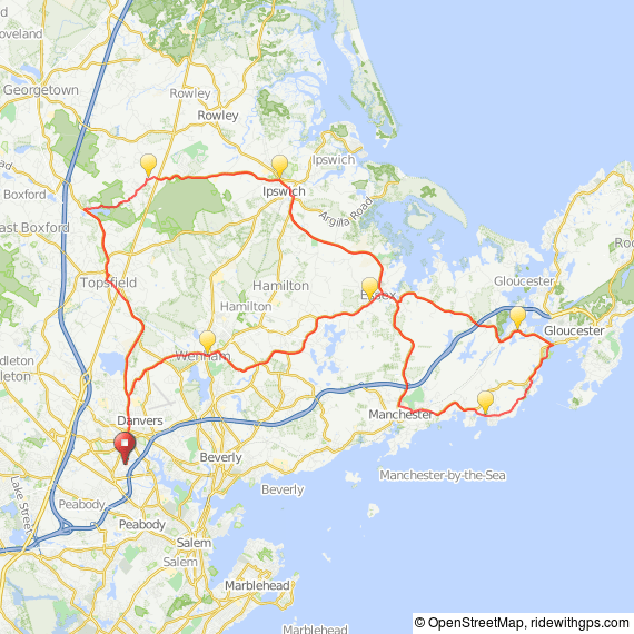
Start location: Salem Commuter Rail Station. Description: 23-mile loop. Visit historic Salem and Marblehead on the Massachusetts North Shore, with great views of the Atlantic. Heavy traffic. Includes the unpaved Marblehead Bike Trail. Route at RideWithGPSView and print cue sheet
Category: north shore
A Reason to Ride, Danvers, MA
A Reason to Ride was a fundraiser to benefit cancer research at Beth Israel Deaconess Medical Center, starting from Danvers, MA, and visiting Wenham, Hamilton, Essex, Manchester by the Sea, Gloucester, Ipswich, Georgetown, Topsfield, and returning to Danvers. 2016 routes 10-mile cue sheet 25-mile cue sheet 50-mile cue sheet 50 miles Route at RideWithGPS View and print cue… Continue reading A Reason to Ride, Danvers, MA
Cape Ann & North Shore Ride
The start location is Pingree School in Hamilton, MA. 100-mile ride Route at RideWithGPSView and print cue sheet View and print map & cue sheetLog in to RideWithGPS & click on More to export GPS files 60-mile ride Route at RideWithGPSView and print cue sheet View and print map & cue sheetLog in to RideWithGPS… Continue reading Cape Ann & North Shore Ride
Danvers, MA Hill Ride
There's an unfortunate scarcity of really hilly routes on the Massachusetts North Shore. This ride ekes out every bit of vertical possible. It produced a ride with 53.08 feet per mile with no hill repeats, though it does feature two out-and-back hills. View this ride at https://ridewithgps.com/routes/12731526 Route at RideWithGPS Viewand print cue sheet View and… Continue reading Danvers, MA Hill Ride
NSC Blazing Saddles Century, Byfield MA, August 16, 2025
Cape Ann from Ipswich
Start: Hammatt St. downtown parking lot, Ipswich, MA map to start Description: Quiet local roads from Ipswich take us to Manchester by the Sea, continuing counter-clockwise for a very scenic tour of Cape Ann's rocky coastline. All routes go through beautiful Magnolia bordering the ocean, and continue past Hammond Castle, a replication of an English medieval… Continue reading Cape Ann from Ipswich
Salem from Ipswich
Depart downtown Ipswich, MA, taking local roads to Beverly, where we cross the bridge to Salem. After riding through the historic neighborhoods in this well-known city, we return to Ipswich through historic downtown Beverly and Hamilton. Route at RideWithGPS View and print cue sheet View and print map (Log in to RideWithGPS & click on… Continue reading Salem from Ipswich
70-Mile Ride from Crane Beach, Ipswich, MA
Ipswich to Plum Island, “Out and Back”
Start Location: Ipswich Middle and Senior High School, Ipswich MA., We start from the parking lot behind the school). This ride takes Rt. 1A from Ipswich through Rowley to Newbury, and then offers options to continue to Newburyport for a 22-mile round trip, or out to the Parker River Wildlife Refuge on Plum Island for a 32-mile round trip. Turns… Continue reading Ipswich to Plum Island, “Out and Back”
North Shore cycling tour
This former cycling tour of the Massachusetts North Shore was developed for Road Scholar by Gordon Hrris, and is based in Ipswich and Newburyport, Massachusetts. The routes for the daily rides are provided below. Ipswich Rides These Ipswich rides start from the Ipswich Inn at the intersection of North Main St. and East St. To the… Continue reading North Shore cycling tour
The Best of Ipswich
Start: Ipswich, Massachusetts, Hammatt St. parking lot, behind Market Street and Central Street: map to start Description: The Best of Ipswich ride features our favorite cycling roads from downtown Ipswich, with a great mix of state forests, cycling along the Ipswich River, and scenic ocean vistas from Crane Beach and Jeffreys Neck, returning through the… Continue reading The Best of Ipswich
Beverly-Ipswich MA Ride
Start: Cove Elementary School, Beverly, MA. map to start What to expect: This Beverly-Ipswich loop travels quiet woodland and open roads near Cape Ann area, including North Beverly, Centerville, Essex, Ipswich, Wenham, and Hamilton. Long and medium rides go out to Jeffrey's Neck loop from the town wharf in Ipswich. After the ride, many participants… Continue reading Beverly-Ipswich MA Ride
Merrimack River Ride from Ipswich MA
Start Location: Ipswich Middle and Senior High School, 130 High St., Ipswich, MA. (We start from the parking lot behind the school). (Map to Start) This ride takes Rt. 1A from Ipswich to Rowley, then continues on pleasant roads past two reservoirs to the Merrimack River in West Newbury. Ipswich-Merrimack River Ride 35 miles Ipswich-Merrimack River route at RideWithGPS… Continue reading Merrimack River Ride from Ipswich MA
Ipswich to Boston Ride
Description: 47 miles along back roads and bike lanes to North Station in Boston. Quiet local roads from Ipswich take us to Topsfield, North Reading, Wakefield, and Stoneham. We then ride along the Mystic River to Arlington, take the Minuteman Bike Path to Cambridge, and follow the Fresh Pond bike path and local bike lanes to the… Continue reading Ipswich to Boston Ride
Ipswich MA 15-Mile Ride
Start: YMCA, 110 County Rd. (Rt. 133 east and 1A south ), Ipswich Massachusetts. map to start and driving directions Directions: Take Rt. 133/1A heading east from Ipswich. Before the highways split, the YMCA will be set back on the left. What to expect: Ride along the quiet roads between Ipswich, Essex, and Hamilton. Short ride… Continue reading Ipswich MA 15-Mile Ride
Salt Marsh Ride, Ipswich, MA
Start: Ipswich MA downtown central parking lot on Hammatt St. behind Market Street and Central Street map to start Directions: From I-95, take Rt. 133 east to the center of Ipswich. Turn right one block before downtown center. Hammatt St. parking lot will be on your left. From Rt. 1, take Ipswich Rd. from Topsfield.… Continue reading Salt Marsh Ride, Ipswich, MA
Ride the Hills of Ipswich
There are about 2300 feet of climbing on this 44-mile ride, with a lot of "out and back" on beautiful roads you may have never ridden. 44-mile Ipswich Hills Ride, 2300 ft. of climb 44-mile route at RideWithGPS View and print cue sheet View and print map (Log in to RideWithGPS & click on More to… Continue reading Ride the Hills of Ipswich
Old Stone Walls Ride from Ipswich, MA
Start: Ipswich, 16 Hammatt Street parking lot, behind Market Street and Central Street. map to start Directions: From I-95, take Rt. 133 east to the center of Ipswich. Turn right one block before downtown center. Hammatt St. parking lot will be on your left. From Rt. 1, take Ipswich Rd. from Topsfield. Cross tracks and… Continue reading Old Stone Walls Ride from Ipswich, MA
Ipswich-Topsfield-Boxford
Ride from Ipswich MA to Topsfield, a charming New England village. A private driveway is used to connect Pineswamp and Topsfield Roads, then continue along beautiful Perkins Row takes you through the Ipswich River Sanctuary before arriving in Topsfield. The long route adds a loop through parts of Ipswich and Boxford west of Rt. 1. Both… Continue reading Ipswich-Topsfield-Boxford
Ipswich-Newburyport 34-Mile Loop
This 34-mile road bike ride begins at the Hammatt St. parking lot in Ipswich, MA, and follows Rt. 1A along the coast to Newbury and Newburyport. The return is along quiet wooded roads west of Rt. 1, then taking newly-reconstructed Linebrook Road back to Ipswich. There is a short extra loop on Pine Swamp Road… Continue reading Ipswich-Newburyport 34-Mile Loop


