This tour begins and ends at Kenneth L Wilson Campground, , 859 Wittenberg Road, Mt. Tremper, NY. The first day heads west through the Catskills, the second day follows the Delaware River to Port Jervis NY, the third day offers an option of loops along the river and through High Point State Park, and the fourth day returns the group to the starting point. The route is about half on highways with wide paved shoulders, and the rest is local roads in good condition with low traffic flow. The campsites have been chosen based on location, desired mileage and campground quality. The average ride distance each day is approximately 80 miles, with some options given. The total distance for this tour is 320 miles, with the option for a 40-60 mile extra day in the Catskills. View a version of this tour with shorter rides
 Mount Trempor to East Branch, with local roads
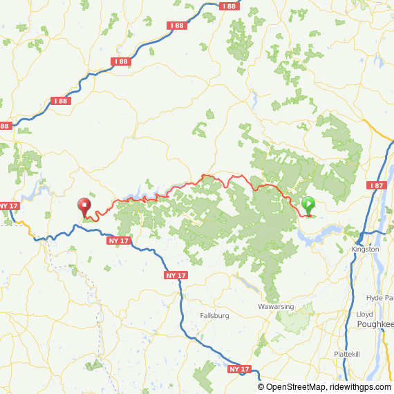
Day 1: Mount Trempor to East Branch, NY.
Heading west from the campground, you have a choice of the new or old highway. Wittenberg Road, Plank Road and Shandage Road are “old Rt. 28” and are paved and in good condition but with little or no shoulder. They parallel Rt. 28 (the new road) which has a wide shoulder. You have several opportunities along the way to change to the highway. I show a highway version and a nearby local roads version of this ride. This area is very remote, and is a mecca for fishermen. Downsville at the west end of the Pepacton Reservoir will probably be the last opportunity to buy food before continuing the last 11 miles to the campground. Six miles before Oxbow you have the option of staying at the Peaceful Valley Campsite in Shinhopple (Downsville), which gets good reviews but there appear to be no stores or restaurants nearby. Oxbow Campsites is at mile 71 (mile 65 highway version) on Rt. 30. You will see the large sign on the left..
 Mount Trempor to East Branch, all-highway route
The town of East Branch is 3 miles ahead near the intersection with Route 17. There is probably no grocery store, but it has the Beaver Del a popular local restaurant /motel with a dozen or so camping spots along the river, on the old Route 17, parallel to the new highway. The Yellow House B&B and Buck-Horn Lodge (rustic cabins) are also in East Branch. You may opt to camp at the Beaver Del to have proximity to the restaurant. The nearest large town is Hancock, 11 miles from Oxbow., 8 miles from East Branch, which is on the next day’s route. RWGPS Map A:A mix of local roads and highway. 71 miles with 4000 ft. of climb, a mix of local roads and highway. View local roads -highway route. RWGPS Map B: All-highway option. Good shoulders., 6 less miles and 600 less ft. of climb., but otherwise the elevation profiles are similar. View all highway route Note: add approximately 3 miles to these mileages if continuing to East Branch. East Branch to Jarvis
Day 2: East Branch to Port Jervis
From the Oxbow Campsites, continue 3 miles on Rt. 30 and head west on Rt. 17 in East Branch (start location if staying at Beaver Del or in town). Head west 10 miles on a mix of Rt. 17 and local roads to Hancock (known for its bluestone and timber) then continue south on New York Bicycle Route 17 , which is NY Rt. 97. View more about the bicycle route at Cycling the Upper Delaware Scenic Byway). You will be on this highway the entire distance to Port Jervis, NY, which was named in 2008 by Budget Travel as the #1 “Coolest Small Town” and is the southern gateway to the Delaware Scenic Bikeway. The Rockview Valley Campground is just a couple of miles after town, across the river at 59 River Road , Montague NJ. Phone: (973) 293-3383 The total distance is 85 miles, total elevation gain 5700 ft., but dropping 500 ft. from the previous evening’s campground. A 5 mile climb about 10 miles afterHancock accounts for 1000 ft. of the elevation gain, after which the road leaves the river several times with approximately 3 mile climbs with 400 ft. of elevation gain. Another camping option before Port Jervis is Kittatinny Canoes and Campground. with 350 camp sites, 21 miles before Port Jervis. All of the campgrounds along the Delaware river focus on fishing. RWGPS Map: View Ride Delaware Water Gap loop (81 mile version)
Day 3: Delaware Water Gap Loop
Today’s ride is a loop that starts and ends at the Rockview Valley Campground near Port Jervis. You can leave your camping gear at the site and explore as much of the Delaware Water Gap as you wish before returning to camp through High Point State Park, which at 1800 ft elevation is the highest point in New Jersey and offers some excellent views. High Point Park Loop Road cycling map. On this route : High Point State Park , 1480 Route 23 Sussex, NJ 07461. Has some nice narrow paved park roads. Camping allowed here but is primitive. Running water and flush toilets, not sure about showers. Group camping has pit toilets only.. Old Mine Rd. continues along Delaware River but ends at interstate, so that section would have to be out and back for extra mileage. Scamp and Rascal Upcountry century tour is similar. 81 mile Delaware River-High Point State Park route (includes some out and back on same road) 58 mile Delaware River -High Point State Park route (fairly similar to 81 but eliminates out and back section) 40 mile Delaware River-High Point State Park route (a bit of the river, then returns through High Point)
 Day 4 back to the Catskills
Day 4 Port Jervis north to Start Location
Start: Rockview Valley Campground 59 River Road Montague, NJ. Destination: Starting point, Kenneth L. Wilson Campground. Address: 859 Wittenberg Road, Mt. Tremper, NY 12457 This ride takes a generally straight course back to Kenneth Wilson Campground., starting with a 40 mile stretch of Route 209. An alternative that adds a few miles is Mountain Road (County Routes 35, 73 and 90) for the first 19 miles, in good condition. but with more elevation. The last section of the ride enters the Catskills and circles Ashokan Reservoir before returning to the campground. View this 76 mile ride at RideWithGPS Shorter option: Port Jervis to Kenneth Wilson Campground. This is an almost identical 65 mile version of the return trip in the 76 mile ride description, with 3300 ft. of climb. The big climb into the Catskills begins at mile 39, with a steep descent at mile 51, then circling the Ashokan Reservoir back to camp. View this 65 mile ride at RideWithGPS.
 Catskill climber, 62 miles
Extra Rides from Kenneth Wilson Campground
Shown here are two options for a climbing ride from the campground in Mount Trempor on highways that have some shoulder, going around Hunter Mountain and through Woodstock just before returning to the campground. Clockwise route gives more gradual climb and steeper descent. Catskill Climber, 62 mile version. 4100 ft. of elevation on RWGPS Catskill Climber, 49 mile version. 3600 ft of elevation. on RWGPS Catskill Climber map You may also choose a route heading southeast from the Kenneth Wilson Campground that passes through Kingston and New Paltz, 75 miles with 4600 ft. of elevation Kingston-New Paltz 75 mile loop Source for this ride. another similar ride at Bike Hudson
