Start: Old North Andover Common; Osgood St., North Andover, MA map to start and driving directions
Directions: I-495 to Rte 114 East (toward Middleton). Left at lights onto Rt.125 (Bertucci’s Pizza). At next set of lights (.2 mi) take right on to Andover St. Follow for approximately .7 mi to the common. From I-95, take Rte 114, R at Rte (Bertucci’s Pizza) then same as above.
Parking: There is plenty of street parking at the ride start. You can also use the large public parking lot at the Hermann Youth Center, corner of Johnson and Salem Streets a few blocks from our ride start location. Map to Hermann Youth Center
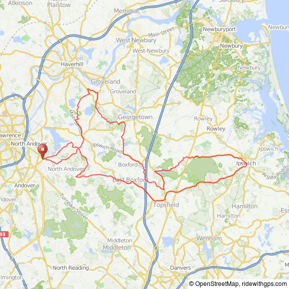
Description: Quiet wooded roads through North Andover, Boxford, West Boxford, Topsfield, Georgetown and Ipswich. (This ride goes through Boxford and much of the route may not be marked; please download the cue sheets and map). Hosted by Tom Quintal for NSC.
Ride Mark: white chevron
 20 mile NSC cue sheet PDF
20 miles at RideWithGPS
Route map
PRINT MAP FROM BROWSER
PRINT CUE SHEET FROM BROWSER
GPX file
TCX file
 28 mile cue sheet
28 miles at RideWithGPS
Route map
PRINT MAP FROM BROWSER
PRINT CUE SHEET FROM BROWSER
GPX file
TCX file
 48 mile cue sheet
48 miles at RideWithGPS
Route map
PRINT MAP FROM BROWSER
PRINT CUE SHEET FROM BROWSER
GPX file
TCX file
