Start: 14 Otis St. Danvers, MA. The start is the dirt parking lot of Tiggies Field across from St. Mary of the Annunciation School. From Rte 1 or 95 take the exit for Rte 62 East (Maple St). In about 1 mile turn right on Pine St. and at 0.2 mi left on Otis. Parking lot will be a short way down on the left. Map to Start

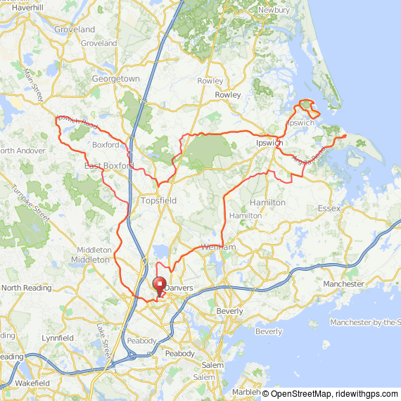
Description: Easy, mostly flat ride on Short and Medium with few hills through Danvers, Middleton, Boxford, Topsfield, Ipswich and Hamilton. Starts out on traveled roads but quickly becomes scenic and less busy passing by two farm stands. The Long ride takes you out to beautiful Jeffrey’s Neck in Ipswich with bay views and both the Long and Medium have option for an “out and back” to Cranes Beach on Argilla Rd. The arrow is a lower case letter “d” with arrow top denoting direction. NOTE: there are no arrows in Boxford. Created by Tom Baldwin.
Short: 28 miles. Medium: 46 miles. Long: 60 miles
Short route: 28 miles
 Short route at RideWithGPS
Short route GPX file
TCX Course
Print Map from Browser
View Cue Sheet from Browser
Short/Medium NSC cue sheet PDF
Medium route: 46 miles
 Medium route at RideWithGPS
Medium route GPX file
TCX Course
Print Map from Browser
View Cue Sheet from Browser
Short/Medium NSC cue sheet PDF
Long route: 60 miles
 Long route at RideWithGPS
Long route GPX file
TCX Course
Print Map from Browser
View Cue Sheet from Browser
Long NSC cue sheet PDF
