Start: Tyngsboro Elementary School; 205 Westford Rd, Tyngsboro, MA map to start
Directions: Take Exit 34 on Hwy 3. At the end of the exit ramp, turn West (left, for those coming from the south), toward Westford. At the third stoplight, turn right. Tyngsboro Elementary School is on your right in less than a 1/2 mile. This ride starts in Tyngsboro, goes through Dunstable, Nashua, and Pepperell. The Medium and Long routes include a loop through Groton. The Long route includes a very hilly 19 mile loop around Hollis, NH. All three routes consist of rolling hills through scenic rural and some urban scenery.
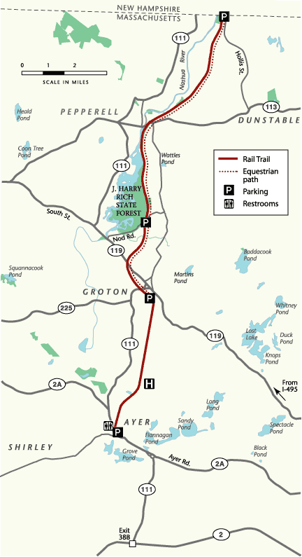
A part of each route rambles back and forth across the Nashua River Rail Trail. The Nashua River Rail Trail opened in 2002 and follows the former Hollis branch of the Boston and Maine Corp. railroad for 11 miles through the towns of Ayer, Groton, Pepperell and Dunstable, with a 10-foot wide paved surface for the entire length. The trail travels along a varied and scenic landscape, and no motorized vehicles are allowed. The Nashua River Rail Trail opened in 2002. Trail Map
Short route 21 miles

Map My Ride short PDF cue sheet
NSC short PDF cue sheet
Short route at RideWithGPS
Short route GPX file
TCX Course
Print Map from Browser
View Cue Sheet from Browser
Medium route 29 miles

Map My Ride medium PDF cue sheet
NSC medium PDF cue sheet
Medium route at RideWithGPS
Medium route GPX file
TCX Course
Print Map from Browser
View Cue Sheet from Browser
Long route 49 miles
 Map My Ride long cue sheet PDF
NSC long cue sheet PDF
Long route at RideWithGPS
Long route GPX file
TCX Course
Print Map from Browser
View Cue Sheet from Browser