Start: Cushing Park, Kent St., Newburyport, MA. Google Directions and Map to Start Location. This is a North Shore Cyclists ride.
Directions: From I-95, Exit 57 for Rte 113 E. Go 2 miles and take a left onto Kent Street. Parking lot is 2 blocks on right. From Rte 1, go onto Merrimac Street (at the Newburyport end of the bridge over the Merrrimack). Go 1/4 mile west towards Amesbury. Take a left at the gas station, and lot is 1 block on left.
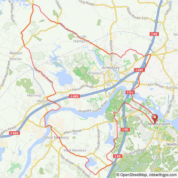
What to expect: The ride heads out on the High St. bike lanes and passes through Maudslay State Park. We swing down through the wooded roads in the Byfield and West Newbury area, then cross the Merrimack River and ride along the river to Amesbury. The long route continues north, passing through Exeter. Lots of rural countryside, a couple of charming New England towns, and beautiful views of the broad Merrimack River. The return includes a few miles on the Old Eastern Marsh Trail in Salisbury.
35 miles
 35 mile PDF cue sheet
35 miles at RideWithGPS
RWGPS cues
Route map
GPX Track (.gpx)
TCX Course
54 miles
 54 mile PDF cue sheet
54 miles at RideWithGPS
RWGPS cues
Route map
GPX Track (.gpx)
TCX Course
