Start Location: Salem Willows Park at the corner of Fort Ave. and Bay View Ave. near “Salem Willows Park” signage in Salem, MA. A bike rack and park benches are nearby. Plenty of parking is available. Map to start.
Description: This is a ride on the streets of historic Salem and surrounding towns. The routes are of varying distances. This ride is in an urban environment that has in places narrow streets and may be heavily trafficked.
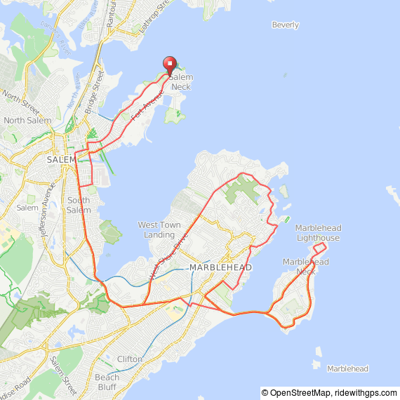
Marblehead Route: Terrain is gently rolling with a few hills. The standard ride goes around the Neck then through Old Town in Marblehead, and is approximately 18 miles in length. Two options increase the distance up to 22 miles.
Beverly Route: Terrain is gently rolling with a few hills. The short (13 mi) and medium (20 mi) options head towards Prides Crossing. The short option loops around Endicott College. The medium option extends to Gordon College, and then swings over to Wenham before returning to Salem.
Downloads:
 Beverly Route Medium
cue sheet
route map at RWGPS
GPX Track (.gpx)
TCX Course
 Beverly Route Short
cue sheet
cue sheet at RWGPS
route map at RWGPS
GPX Track (.gpx)
TCX Course
 Marblehead Route Long
cue sheet at RWGPS
route map at RWGPS
GPX Track (.gpx)
TCX Course
 Marblehead Route Short
cue sheet at RWGPS
route map at RWGPS
GPX Track (.gpx)
TCX Course
