
Friday afternoon
A choice of an easier ride to Sheffield or a couple of steeper ride options to North Egremont and Alford
Easy ride: South Egremont-Sheffield
Distance: 18.1 mi. Elevation: + 594 ft with a short section of unpaved road)

View/print South Egremont-Sheffield PDF cue sheet
Route at RideWithGPS
View and print cue sheet
View and print map
GPX file
TCX Course
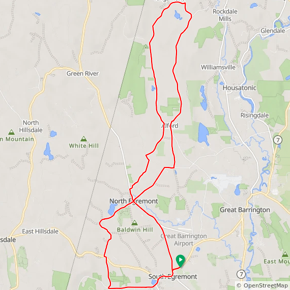
27 mile North Egremont and Alford ride
Distance: 26.6 mi. Elevation: 1686 ft
View/print 27 mile PDF cue sheet
Route at RideWithGPS
View and print cue sheet
View and print map
GPX file
TCX Course
Print PDF cue sheet (requires RWGPS login)
17 mile North Egremont and Alford ride
Distance: 17 mi. Elevation: + 1014 ft. (eliminates Mount Washington climb)
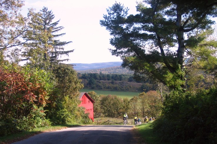
This ride begins at the Windflower Inn. We head west to the foot of the Taconic mountains and then take back roads to North Egremont. From there, Rt. 71 to the New York state line is a straight and scenic a roadway with views of the mountains the entire way. We circle north through Alford before looping back through Alford to the inn.

View/Print 17 mile PDF map and cue sheet
Route at RideWithGPS
View and print cue sheet
View and print map
GPX file
TCX Course
Saturday
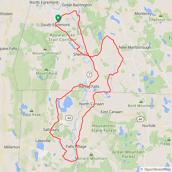
Mill River (medium route)
Distance: 34 mi, Total elevation: + 1240 ft.
This classic Berkshire ride starts out with some easy cycling along the flat flood plain of the Housatonic River through Sheffield farmland to Mill River, with an optional gravel side route to Umpachenee Falls. The return includes an exhilarating downhill ride back to the Housatonic River before returning to Sheffield, where you may want to stop by the oldest covered bridge in Massachusetts.

MILL RIVER PDF CUE SHEET
Route at RideWithGPS
View and print cue sheet
View and print map
GPX file
TCX Course
Twin Lakes and Mill River (long route)
Distance: 57.1 mi Elevation: 2380 ft
TWIN LAKES MILL RIVER PDF CUE SHEET
Route at RideWithGPS
View and print cue sheet
View and print map
GPX file
TCX Course
Sunday
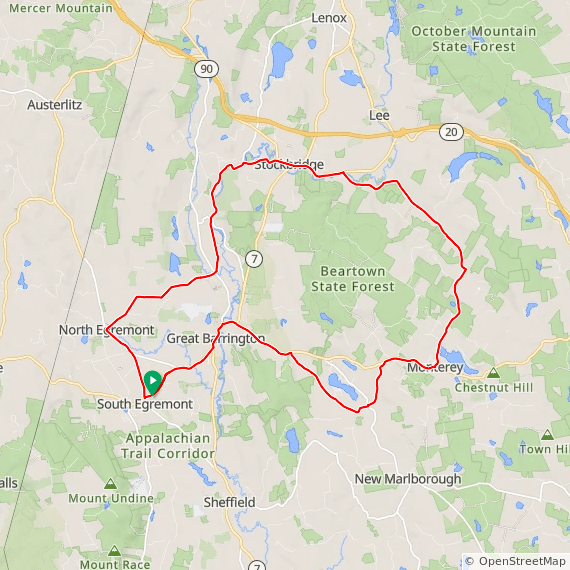
Alford, West Stockbridge and Stockbridge

ALFORD-W. STOCKBRIDGE-STOCKBRIDGE PDF CUE SHEET
Route at RideWithGPS
View and print cue sheet
View and print map
GPX file
TCX Course
Alford, West Stockbridge, Richmond and Stockbridge (long version)
Distance: 47.4 mi. Elevation: + 2661 ft

ALFORD-RICHMOND-STOCKBRIDGE PDF CUE SHEET
Route at RideWithGPS
View and print cue sheet
View and print map
GPX file
TCX Course
Other rides
Monterey and Tyringham
Distance: 39.8 mi. Elevation: + 2040 ft
This scenic 40 mile ride goes through downtown Great Barrington Massachusetts and heads out of town up “Three Mile Hill. We circle around Lake Buel, then top to check out the Berkshire Fish Hatchery in Hartsville. Continue on to Monterey, MA, and stop for refreshments at the Monterey General Store. The ride continues past Lake Garfield with a sweeping descent into the Tyringham Valley. Make sure to stop to view the Gingerbread House in Tyringham just before taking a left to South Lee.
After turning left on Rt. 102, you’ll see an impressive dam and spillway on the left, part of a still-operating paper mill. Continue on to popular Stockbridge, whose attractions include the Red Lion Inn, Berkshire Botanical Garden, the Norman Rockwell Museum, and Chesterwood, home of Lincoln Monument sculptor Daniel Chester French. The return from Stockbridge follows the flowing rapids of the Housatonic River back to Great Barrington.
Tyringham Ride PDF cue sheet
Route at RideWithGPS
View and print cue sheet
View and print map
GPX file
TCX Course
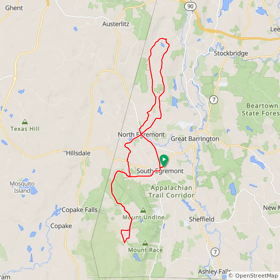
Mount Washington, Bash Bish Falls, Copake NY
Distance: 40 mi, Max Grade: 10.0 %, Elevation: 3400 ft
This is one of the most challenging rides in the Berkshires, with an ascent of several miles from South Egremont, riding past Mount Everett, the second highest mountain in the state to the end of the road in tiny hamlet of Mount Washington. Here we take an amazing descent down the winding paved road past Bash Bish Falls to the community of Copake Falls, NY. Ride on the paved Harlem Valley Rail Trail before cycling for several miles through New York State farm country. The ride crosses a pass in the Taconic Mountains for the return to South Egremont.This ride is approximately 40 miles. View at RideWithGPS

Mount Washington-Bash Bish ride at RideWithGPS
View Cue Sheet from Browser
Print Map from Browser
GPX file
TCX Course
Mount Washington, North Egremont, Alford 41 miles
Distance: 41.1 mi Elevation: + 3174 ft
We head west to the foot of the Taconic mountains, then reverse course, with two distance options in North Egremont and Alford.
View/print 41 mile cue sheet
41 mile route at RideWithGPS
View and print cue sheet
View and print map
GPX file
TCX Course
Print PDF cue sheet (requires RWGPS login)
Mt. Washington- N. Egremont-Alford 31 miles
Distance: 31.5 mi Elevation: + 2507 ft

31 mile Washington-North Egremont cue sheet PDF
Route at RideWithGPS
View and print cue sheet
View and print map
GPX file
TCX Course
