
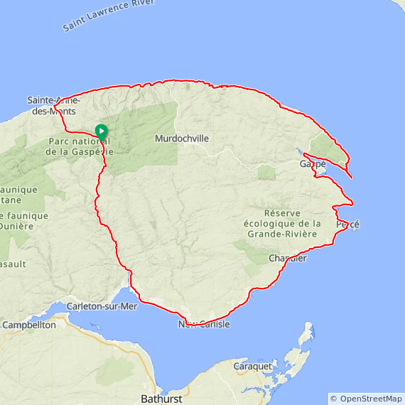
Overview
This five-day tour of the coastal and mountain areas of Gaspe offers approximately 80 miles per day. The coastal ride from the northern shore of Gaspe to the towns of Gaspe and Perce is a favorite cycling adventure. This tour crosses the mountains in Parc National de la Gaspesie to loop back to the start destination. With the exception of secions of the road on Day 2, and the return over the mountains on Rt. 299, this tour follows La Route Verte.
The 5 day option starts and ends at Parc National de la Gaspésie. The 6 day version begins on the coast at Chit Chat.
Overview Full Five Day Route at RideWithGPS
View and print map
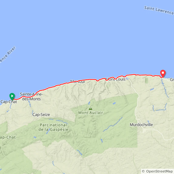
Alternative start (for 6 day tour)
Description: Cap Chat is a small fishing village, dominated by the wind farm and downhill ski slopes nearby. The road to Riviere La Madeleine is probably the most memorable coastal part of the tour, generally with generous tail-winds that help you maintain good speed along the coast and the mountains. The road follows the coast, and the area is sparseley populated.
Start: Motel Nanook, Cap Chat
End: Hôtel Motel Bon Accueil, Riviere La Madeleine
Distance: 67.1 mi Elevation: + 3600 / – 3592 ft
Alternative Day 1 Route at RideWithGPS
View and print cue sheet
View and print map
GPX file
TCX Course
Alternative_Gaspe_6_day_tour:_Day_1 PDF map and instructions
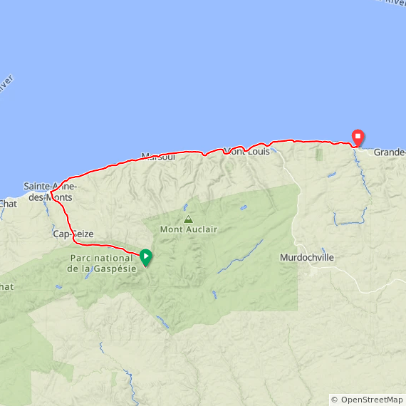
Day 1 (5 day tour)
Today’s ride begins with a descent from Park National Gaspesie to the shore at Saint-Anne-Des Monts. The ride to Riviere La Madeleine is coastal with good shoulders and generous tail-winds. The ride ends just before the road climbs away from the coast.
Start: La Gite du Mont Albert, Park National Gaspesie;
End: Hôtel Motel Bon Accueil, Riviere La Madeleine
Distance: 83.2 mi, Elevation: + 3896 / – 4686 ft
Day 1 Route at RideWithGPS
View and print cue sheet
View and print map
GPX file
TCX Course
Gaspe_5_day_tour_Day_1 PDF cue sheet and map
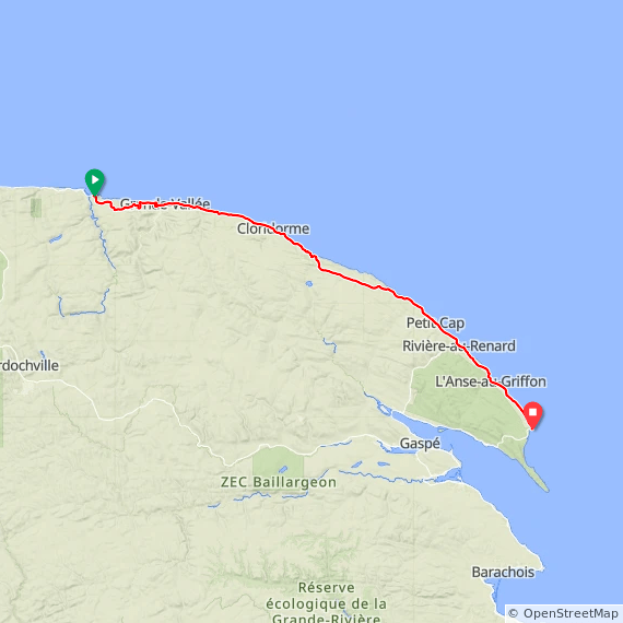
Day 2
From Riviere La Madeleine the route leaves the coast and goes through the mountains, reaching the coast again at Grand Valee. This is the only significant section of Rt. 132 that has sections with little or no shoulder, and is thus not included in La Route Verte.
Start: Hôtel Motel Bon Accueil, Riviere La Madeleine
End: Hôtel Motel Le Pharillon, Cap-des-Rosiers
Distance: 65.1 mi; Elevation: + 5987 / – 5984 ft
Day 2 Route at RideWithGPS
View and print cue sheet
View and print map
GPX file
TCX Course
Gaspe_5_day_tour_Day 2 PDF map and cue sheet
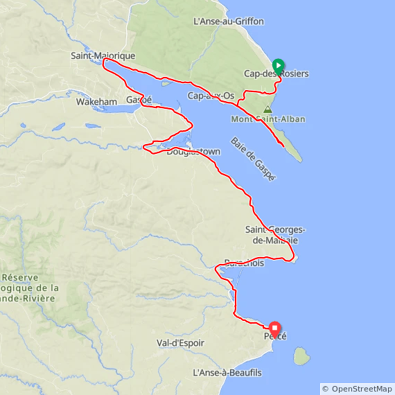
Day 3
From Cap-des Rosiers, today’s ride crosses la Parc national de Forillon, and offers an optional ride out along the Park’s peninsula. The ride continues through the popular town Gaspe, ending in the equally popular Perce. The last few miles include some extreme grades, followed by a steep descent into the town (no shoulder on this descent).
Start: Hôtel Motel Le Pharillon, Cap-des-Rosiers
End: Hôtel Motel Manoir de Percé, Percé
Distance: 86.3 mi; Elevation:+ 4827, -4827 ft
Day 3 Route at RideWithGPS
View and print cue sheet
View and print map
GPX file
TCX Course
Gaspe_5_day_tour_Day_3 PDF cue sheet and map_
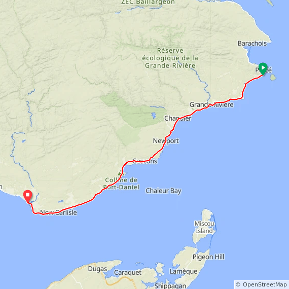
Day 4
Today’s ride follows the south shore, not quite as popular with tourists, but with wonderful coastal scenery the entire way from perce to Bon Adventure. This is the only section of the tour where you are likely to encounter some headwinds.
Start: Hôtel Motel Manoir de Percé, Percé
End: Motel Grand-Pré, Bonadventure
Distance: 77.5 mi, Elevation: + 2763 / – 2921 ft
Day 4 Route at RideWithGPS
View and print cue sheet
View and print map
GPX file
TCX Course
Gaspe_5_day_tour_Day 4 PDF cue sheet and map
Day 5
From Bon Adventure, the tour leaves La Route Verte and begins a continuous climb to Parc national Gaspesie. The road has a full shoulder. Make sure to have food and beverages because the entire area is mostly unpopulated. The destination is the starting point for the five day version of the tour.
Start: Motel Grand-Pré, Bonaventure
End: La Gite du Mont Albert, Park National Gaspesie
Distance: 84.6 mi Elevation: + 4025 / – 3229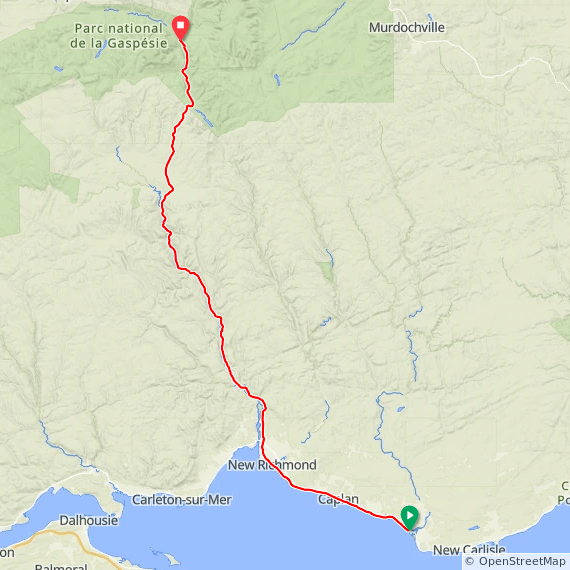 Day 5 Route at RideWithGPS
View and print cue sheet
View and print map
GPX file
TCX Course
Gaspe_5_day_tour-_Day_5 PDF cue sheet and route map
Alternative end for 6 Day tour
For the six day version, today’s ride descends from Park National Gaspesie to the north shore, where you will retrace the coastal ride to Cap Chat.
Start: La Gite du Mont Albert, Park National Gaspesie
End: Motel Nanook, Cap Chat
Distance: 33.3 mi Elevation: + 1024 / – 1820 ft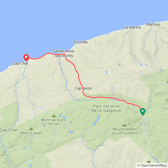
Alternative Day 6 Route at RideWithGPS
View and print cue sheet
View and print map
GPX file
TCX Course
